Summary
Headline: Finland land survey flights unable to operate due to continuous GPS/GNSS-jamming in southeast Finland
Short Summary: Persistent GNSS-jamming disrupted yearly land survey flights in southeast Finland, causing financial losses and highlighting extensive electronic warfare interference.
Description and Notes
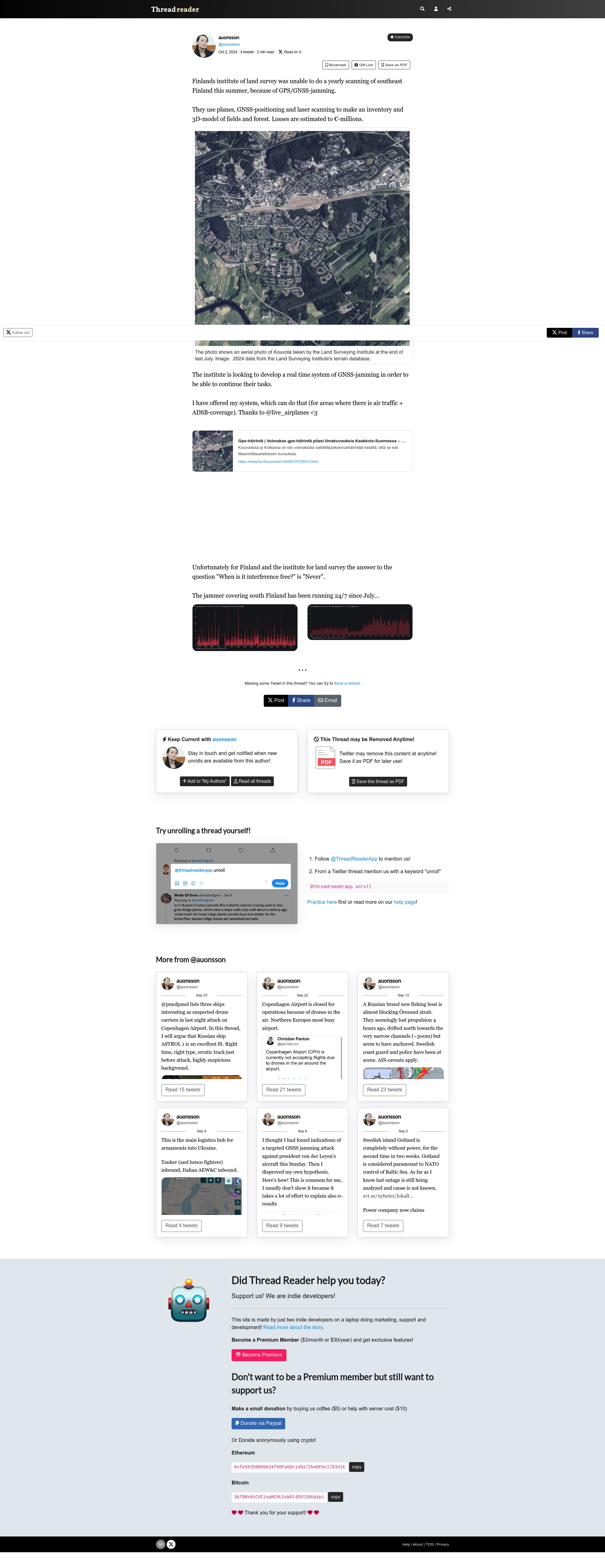
The Finland Institute of Land Survey was unable to conduct its yearly scanning of southeast Finland due to persistent GPS/GNSS-jamming, significantly disrupting aerial surveys critical for inventory and 3D mapping of fields and forests. Losses are estimated to be in the millions of euros. The interference has reportedly been constant in southern Finland since July, preventing effective land surveying operations.
Notes: Millions losses in 3D survey from jamming
Evidence
- "Finland institute of land survey was unable to do its yearly scanning of southeast Finland this summer, because of GPS/GNSS-jamming."
- "They use planes, GNSS-positioning and laser scanning to make an inventory and 3D-model of fields and forest. Losses are estimated to 8+ millions."
- "The jammer covering south Finland has been running 24/7 since July..."
Location
Location: southeast Finland
Processed Payload
Raw Payload
Payload History
Re-enrichment
Re-enrich
Enrichment-only: keeps existing processed data, screenshots, and media. Re-runs only the enrichment step (AI extraction) without refetching the source or regenerating screenshots. Use this if enrichment failed or you need updated AI-extracted data.
Destructive Actions
Delete Event
⚠️ Warning: This permanently removes the event and its history. This action cannot be undone.